Many districts now have access to parcel data contained and managed by
ArcGIS, a product of ESRI, Inc. Aerial Services provides two levels of interface
capability.
Survey Attribute Interface
The Survey Attribute Interface is composed of a set of shape files (shp,
prj, trk, dfb and others) that allow the flight data and image locations to be
imported into ArcGIS. This allows you to view where each of our survey photos
was taken.
Target Location Interface
The Target Location Interface is a process whereby the Target Attribute table
is joined to a ArcGIS Parcel Map layer producing an enhanced Target Attribute
table containing, as available, the parcel address, district or technician
identifier, and other available Location Based Attributes.
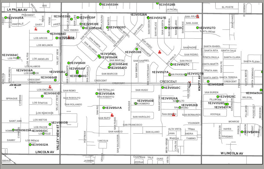
The following ArcGIS map image is taken from an August 2008 flight over
Orange County, California. It shows the exact location of all of the targeted
pools, and the data table is available with the complete ArcGIS attribute list.